
On the morning of Jan. 8, 2025, a red dot popped up on NASA’s Fire Information for Resource Management System. It was the first sign of what would become one of California’s worst wildfires in history, going on to claim a dozen lives and burn down thousands of homes in the Palisades. All the while, the Aqua satellite was orbiting above, scanning the planet and beaming data down to ground stations in Alaska and Svalbard.
This satellite carries infrared sensors that capture changes on Earth impossible to see with the human eye, making it vital for coordinating emergency responders during natural disasters. Upon detection, NASA converts Aqua’s infrared wave data into GPS coordinates, allowing officials to plot the spread of fire as points on a map. These coordinates make up what’s known as the Moderate Resolution Imaging Spectroradiometer (MODIS), an instrument that spots fires on the Earth’s surface. This process often alerts emergency services faster than 911 calls from the ground.
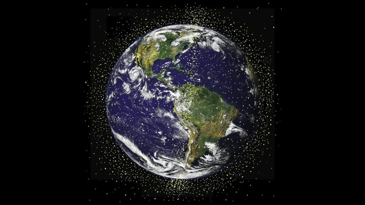
Missing data is a problem for scientists trying to explain the Earth’s climate to politicians and business leaders who make decisions on what to do about climate change. While the data loss is currently small, scientists say the problem will only get worse over time as space debris increases.
But Aqua isn’t alone. It’s one of three main satellites that make up the core of the Earth Observing System (EOS), a constellation that coordinates orbit to measure the land, ocean and atmosphere simultaneously.
The EOS fleet has allowed us to understand how aerosols affect cloud formation, map the deforestation of the Amazon, and discover how the Earth’s oceans have darkened thanks to phytoplankton blooms. And indeed, all three satellites — Aqua, Terra and Aura — are at risk from space junk. Starting in 2005, the EOS fleet swerved to avoid space debris on at least 32 occasions. The maneuvers may have left corrupted climate data in several of those instances, according to data logged by the Land Data Products Evaluations Assessment. Even beyond data, there is also the loss of precious fuel.
“Even without collisions, space debris has an economic cost,” Andrew Bonwick, vice president at Relm Insurance, which offers satellite insurance and has to price in the risk of collision, told Space.com. “Each time a satellite has to maneuver to avoid a potential collision, it uses fuel which is a finite and precious resource.”

“Things will get worse before they get better,” said the NASA scientists in the 2018 report that assessed debris maneuvers. The report found that the risk of a collision between an EOS satellite and a piece of orbital debris is increasing.
In its heyday, Aqua flew around 438 miles (705 kilometers) above the surface of the Earth, moving from the North Pole to the South Pole in an ellipse 14 times a day, scanning the entire planet. The satellite sits in sun-synchronous orbit, capturing the light waves emitted from the Earth’s surface.
Along that journey, Aqua has survived a battery short-circuiting, a solar panel thermistor failure, and lost 23 of its solar cell strings. But thanks to careful fuel management, the satellite has lasted 18 years longer than originally designed.
“If we knew we were going to have a spacecraft and instruments that would last 20 years, we might have put more fuel in it so that it would last even longer,” said Aqua Project scientist Claire Parkinson in 2022.
Climate satellites like Aqua are more at risk from debris because they have to fly close to the planet to capture their data. Low Earth Orbit (LEO) has the highest amount of space junk, trapped there by the Earth’s gravity and travelling at faster speeds than the upper atmosphere.
In 2005, the European Space Agency (ESA) was tracking about 16,000 pieces of debris. By 2026, that number had increased to more than 44,000, an increase of about 180%.
The vast majority of space debris is too small to be tracked, with ESA estimating that more than a million small pieces are unaccounted for. Even a speck of paint can be enough to wreck a satellite.
Space junk is created when satellites break up in orbit, either because of collisions or anti-satellite tests such as those carried out by China and Russia. On April 28, two Russian spacecraft passed within 10 feet (3 meters) of each other.
But space junk avoidance isn’t the main reason satellites use fuel. If left alone, Aqua would eventually drift off course. Gravity from passing mountains and ocean bulges slowly pulls the satellite out of orbit, while solar radiation changes its spin, corrupting its data.
For that reason, scientists constantly have to correct satellite trajectories to avoid spacecraft crashing into other spacecraft or even just random bits of space junk. While it’s true that spending fuel shortens the life of a satellite, avoiding space debris is usually worth it. Most of Aqua’s fuel was used on orbital-course corrections.
“For applications where satellites are tasked to provide detailed imagery of particular areas, the job may just not get done, especially where the imagery is time critical or depends on frequent revisits,” says Bonwick.

Now, Aqua is reaching the end of its life span. It’s set to be switched off this year after traversing the skies for almost a quarter-century, leaving behind a legacy for future climate scientists. Less than 66 pounds (30 kilograms) of fuel remains, held in reserve for the time Aqua is lowered into the atmosphere and safely burned up. Until then, the satellite continues its orbit, like a car in neutral rolling down a hill.
After it’s switched off in the fall, Aqua will no longer have enough fuel to dodge incoming space junk. The risk of collision for U.S. government satellites is supposed to be 1 in 1,000, but the risk increases once fuel runs out.
In 2007, when China destroyed one of its own satellites, multiple satellites had to maneuver to avoid space debris, raising concerns about the possibility of Kessler Syndrome, where satellite collisions begin to cascade, like dominoes.
There have been four confirmed space collisions, according to the ESA, but only one involving a climate satellite: An incident in 2021 when a piece of debris from a Russian Zenit-2 rocket hit China’s Yunhai-1 02 meteorological satellite.
The danger is increasing, with ESA estimating a 20% rise in collision risk since 2024. Because of the increased risk, satellites have become almost uninsurable, meaning NGOs and government agencies are increasingly bearing the cost of threats to climate satellites.
MethaneSAT, a satellite designed to capture methane emissions to help better understand the greenhouse gas, stopped transmitting data in 2025 only fifteen months into its life cycle. After high solar activity, the satellite suddenly shut down. Investigators couldn’t agree why.
“If that satellite had not been insured, that would have killed the whole company,” says Bonwick. “It’s not just balance sheet protection, it’s survival.”
The MODIS fire-tracking dataset is set to continue until Aqua and its partner satellite Terra are turned off. NASA, which responded to an initial email from Space.com but has yet to answer specific questions concerning the issue, is continuing its fire detection capabilities through the Visible Infrared Imaging Radiometer Suite (VIIRS), a database that survives on multiple NASA satellites.
But with the space agency suffering from government cuts, private firms are now filling the gap. Google has published plans to launch a constellation of satellites specifically for fire detection, which promises to capture even smaller fires at greater resolution than before.
On May 4, Aqua celebrated its 24th birthday. It will probably be its last. It completed more than 126,000 orbits of the Earth, and enabled at least 30,000 scientific publications.
The satellite leaves behind one of the longest single-satellite climate data records ever compiled. Its contributions to climate science will be hard to replace.